The Magic Bus project at our school enables students to track all the buses on the university bus system in real time, using GPS. They have a really cool Google Maps mashup, with little blue buses crawling around Ann Arbor’s map. Since these interfaces are quite detailed and javascript heavy, they don’t really lend to a great user experience on the iphone (actually, i dont even know if the mashup works on the iphone).
Enter Magic Bus for the iPhone, available at
This web-app simply takes the Magic Bus data feed and reformats it in an iPhone-friendly manner. Each route is listed in a section with its stops, and the number of minutes until the next bus (and the ones after them) at that stop.
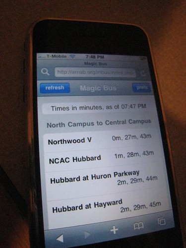
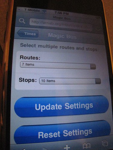
Tap on “prefs”, and you can pick and choose only the routes and bus stops you are interested in, since it’s a little unwieldy to see 43 bus stops and 9 routes at the same time. (This also makes the load times faster)
Ironically, I wrote this almost a year ago; I just didn’t have the time to document it and tell people about it. Hopefully, people will use it now!